Trail Name: Spion Kop Hiking Trails - Upper Lakes Trail Head
Trail Length: 5-7 Kilometres, 2-3 hours
Trail Difficulty: Moderate-Difficult
Directions:
Located in Lake Country, turn Northwest off Highway 97 onto Oceola Road. Turn right on Lake Hill Drive, then left onto Shoreline Drive, straight through the four-way stop and a left onto Apex Drive. Travel on Apex drive for 7 Kilometres and turn left, then a quick right and follow onto the Spion Kop Hiking Trailhead parking lot. Depending on the road closure up to the parking lot, you may have to park along Apex Drive and walk in.
Description:
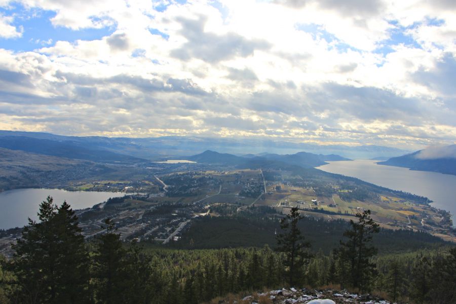
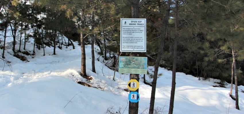
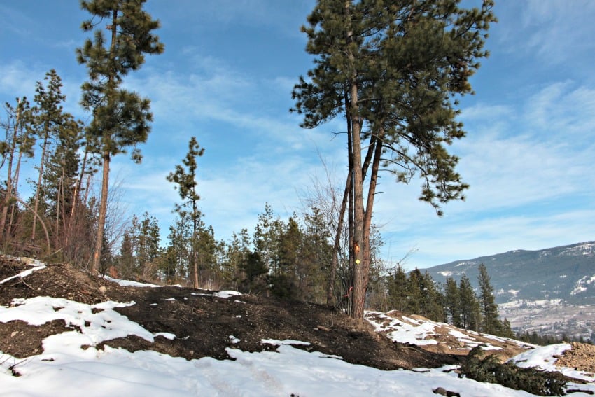
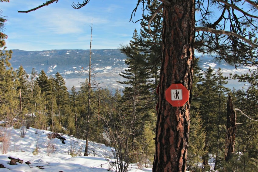
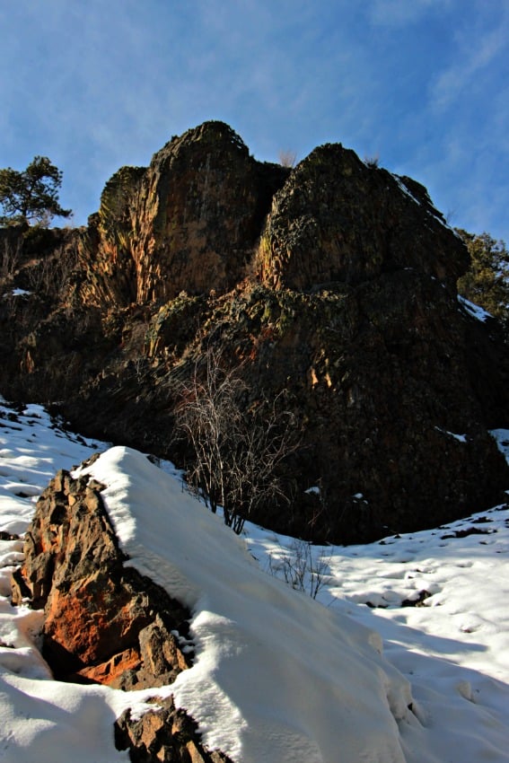
The Spion Kop Hiking trails offer an incredible view of the Okanagan Valley, with four different trailhead locations to choose from! We decided to start at the Upper Lakes Trailhead. Currently due to new development, the trailhead was a little tricky to find. Keep your eyes out for the orange flagging ribbon which will lead you to the yellow trail markers. Once we were following the correct markers, it took us up the Arrow Leaf Trail. This trial led us through the forest. This steep but rewarding hike, gives a good view overlooking Wood Lake for the majority of the way. We soon came to a trail map with a decision to go towards the Summit or The Grand Overlook. From here, we decided to go right towards the Summit. As the trail gets steeper, the views extend overlooking Ellison Lake and the Okanagan Lake. With the tower now in plain sight, we knew the top was close! Coming around the tower to the summit, the view is just incredible! After a little break and some photos, we slowly worked our way back down the trail. Before coming to explore the Spion Kop trails, I had read that this is a "hiker's paradise." I fully agree with this statement! The trails are endless!
The Walk Around Lake Country group has done an amazing job with trail maintenance and trail markers. You can pick up a trail map at the Pelmewash Parkway trailhead or download one online.
Please always be mindful of your surroundings, pack out what you pack in, stick to the trails, and happy exploring!
Things to have:
- Good hiking shoes
- Bear spray (always a good thing to carry)
- Water
- Hiking Poles, if needed
- Camera/Phone
*Dogs are welcome

Born and raised in the Okanagan, Kristy Draginda always had a strong passion for the outdoors. Whether it be hiking to the top of a mountain or standing below a waterfall she says there is no better feeling than being inspired by nature. Follow along as Kristy shares different hiking locations in and around the Okanagan. For more adventure photos check out Hiking the Okanagan on Instagram or Facebook.


