(UPDATE: Feb. 25 @ 3:30 pm) - We're starting to see the affects of a frontal system that's been moving inland over the past 24 hours.
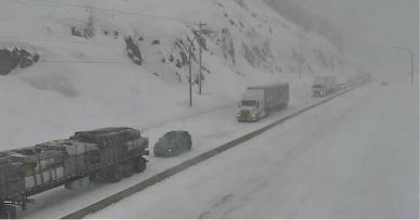
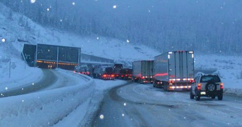
Inclement weather has hit the Coquihalla Highway (Hwy 5), causing driving conditions to deteriorate, as a winter storm warning remains in place for the mountain pass.
A vehicle incident earlier in the afternoon has caused southbound delays and webcams show traffic lined up near the summit.
Environment Canada's winter storm warning remains in place for both Hwy 5 and Hwy 3, both west and east of Osoyoos.
The alert was originally issued last night, calling for 30 centimetres of snow to fall on both routes by Friday morning.
While some of that has certainly been deposited on the roads already, there's still more snow to come over the coming hours.
Anyone whose travel needs aren't essential or urgent is advised to avoid driving these mountain passes right now.
For all the latest road conditions and highway closures, visit the DriveBC website.
(Original story: Feb. 24 @ 4:30 pm ) - It’s an absolutely beautiful day in the neighbourhood, but British Columbians know that can change in an instant.
More winter weather is on the way to the BC Interior, which is going to create some treacherous driving conditions on certain highways and mountain passes.
As a result, Environment Canada has issued a ‘winter storm warning’ for both the Coquihalla Highway (Hwy 5) and Hwy 3.
“An approaching frontal system will move inland tonight and across the BC interior on Thursday,” the alert reads.
“Snow is expected to begin tonight then become heavy at times through Thursday. Snowfall amounts near 30 centimetres can be expected by Friday morning.”
For Hwy 3, it’s 30 cm expected around the Allison Pass between Hope and Princeton, but the highway will be affected in the Kootenays as well.
Environment Canada is calling for around 15-20 cm of snow by Thursday evening around the Paulson Summit and Kootenay Pass.
“Rapidly accumulating snow could make travel difficult over some locations. Visibility may be suddenly reduced at times in heavy snow,” the alert adds.
“Weather in the mountains can change suddenly resulting in hazardous driving conditions.”
Anyone needing to travel over the next two or three days is advised to do so cautiously and check DriveBC for the latest conditions and highway closures.


