New maps have been provided by the Central Okanagan Emergency Operations Centre showing the extended flood areas for Kelowna if Okanagan Lake rises to the projected level of 343.5 metres.
The map displays at risk areas from the bottom of Knox Mountain to the Lower Mission.
Orange shows the potential lake level if there were no flood protection measures in place, and yellow denotes the high water table and influence from rising ground water.
Click here for more information on rising groundwater.
Areas at risk include waterfront properties, properties located at the mouth of creeks and rivers, as well as low laying areas.
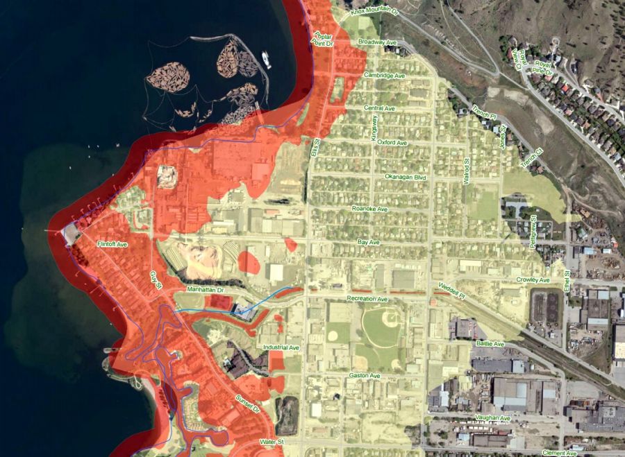
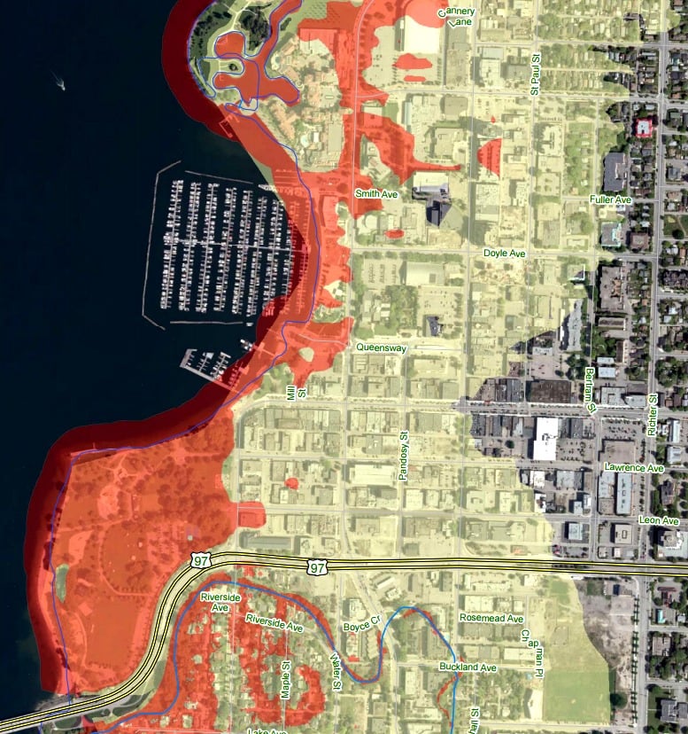
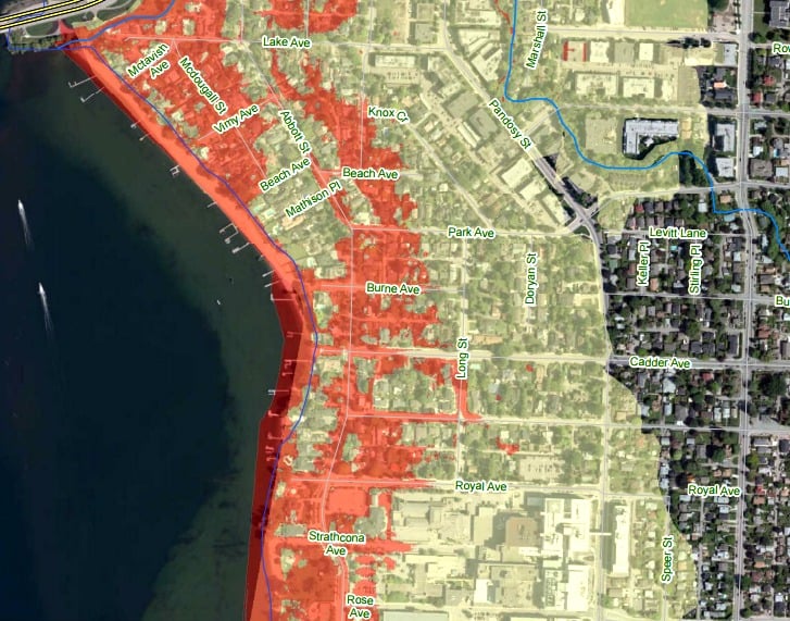
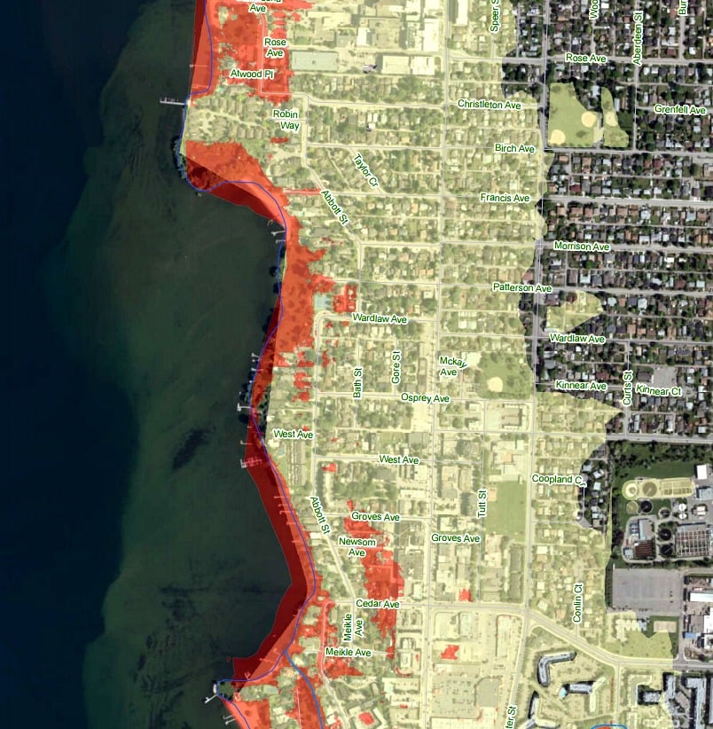
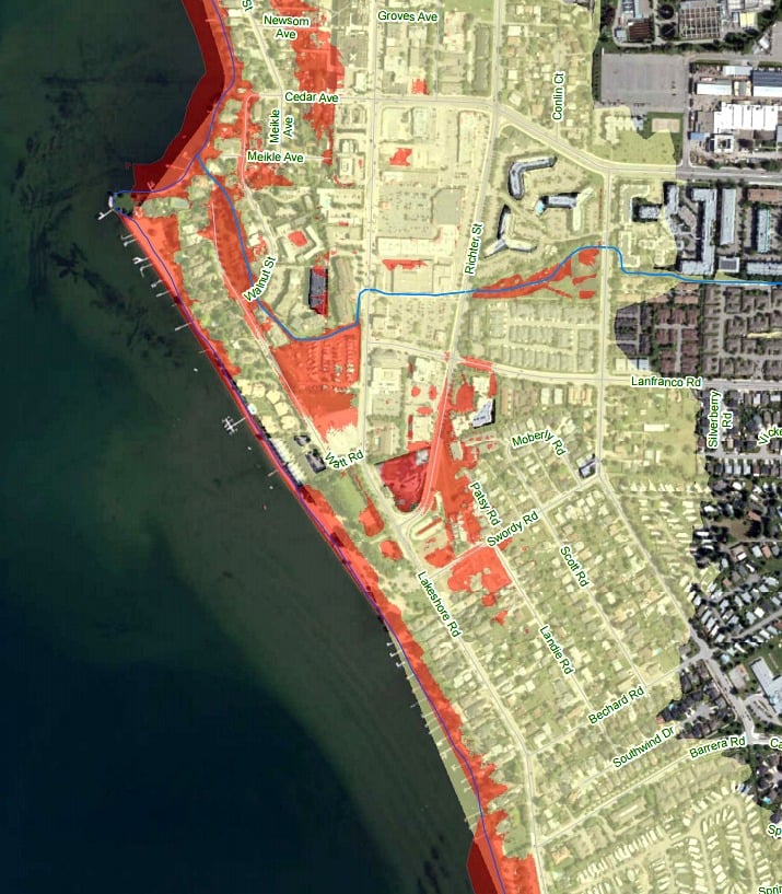
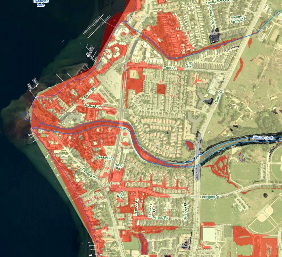
According to the CORD release, ground water levels are often a week or two behind increases to lake levels, so residents should monitor lake levels and their properties to help anticipate their flood risk.
Residents who think that they are at risk should install or bolster flood protection measures, like sandbag dikes, as well as remove valuables from basements and crawlspaces.
For a full look at the new maps, click here.


