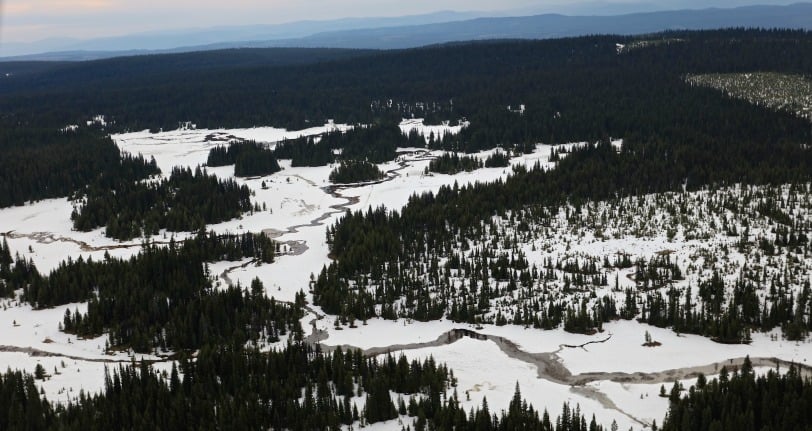
Many photos have been circulating on social media showing that despite reports saying most of the snowpack is gone, there is still a significant amount of snow to be found in higher elevations.
Earlier this week, CORD Emergency reported that in one day, the snowpack went from 50% to 30% remaining in high elevation areas.
Over two days, the snowpack went from 30% to mostly gone.
To clear up this misunderstanding of numbers, we asked Dave Campbell to provide a run-down on the snowpack percentages reported over the past week.
Dave Campbell is with the River Forecast Centre for B.C.
Earlier this week, the Ministry of Forests, Lands and Resource Operations also reported during a media conference that most of the snow was gone from high elevation areas.
Later this week, Campbell further explained his answer to the snow being mostly gone.
"In the context of my comments that 'most of the snow is gone,' - (it) is based on the Okanagan basin as a whole. Only a very small portion of the area that drains into Okanagan Lake is the high elevation terrain that surrounds Mission Creek," said Dave Campbell, River Forecast Centre.
"I don't have the exact number, but approximately 10% of the drainage area into Okanagan Lake is above 1700 metres - the elevation that the Mission Creek snow station is roughly at."

"Based on surveys of snow stations at lower elevations in the watershed, and aerial overview flights that have been taken over the past one to two weeks, there is essentially no or very limited snow below 1700 metres from 90% of the area that drains into the lake," he said.
Essentially, Campbell said that most of the snowpack impacting Okanagan Lake is gone.
Campbell and his team have mainly been using the real-time automated snow weather station for their information on the high elevation snowpack and upper elevations of Mission Creek.
"I'm not sure about the CORD media releases, but I suspect they use this site as their measure of snow pack."
According to Campbell, the Mission Creek snow station started out early in the season with about 600 millimetres of snow water, (which tells you how much water is store in the snow).
"The amount of snow at the Mission Creek station had dropped to 50% of the snow (approximately 300 mm of water remaining) on June 2nd. On June 5th there was 246 mm (41%) and June 7th was at 180 mm (30% remaining)," said Campbell.
As of Wednesday morning Campbell said there was 132 millimetres or 22% left.
What this means, according to Campbell, is that he predicts that station will be out of snow within a week, based on the current rates of melt.
What are your thoughts?
We value your comments and questions.
If you have any questions about the flood that have not yet been answered in any of our flood-related articles, please email us at: news@kelownanow.com


