While the summer heat of the Okanagan is what attracts people to both live and visit our valley, by August it becomes a contributing factor to the severity of our wildfire hazard.
In fact, it's the current weather conditions, combined with the weather of the previous few years (different growing conditions produce more or less wildfire fuel) that significantly influence where the fire hazard rating is.
It’s not just the heat though - Think for a moment of the hot, but humid conditions in the tropics. The moisture in the soil, the plants and the high humidity level in the air, are a deterrent to the spread of wildfire in areas that are both hot and humid.
So it’s the weather, but more specifically temperature, humidity and also the wind that need to be assessed on a daily basis to establish a wildfire danger rating.
At this point in our summer, it’s not unusual to be concerned with wildfire hazard. Temperatures are hot, conditions are dry and as a result, the vegetation that was grown under the cooler, moister conditions of spring, is now dry kindling waiting for an ignition source.
There is a tipping point however, that causes for extra concern for wildfire forecasters called the 30-30-30 Crossover Rule.
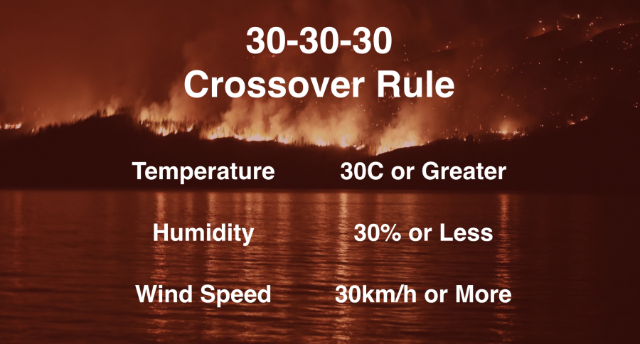
Should a wildfire start while the temperature is 30C or above, the relative humidity is 30% or less and the wind speed is 30km/h or stronger, it will exhibit extreme fire behaviour and be difficult to control until weather conditions change.
Here in the Okanagan, if this tipping point is going to be reached, it will happen in the afternoon and continue into the evening.

Temperature and moisture content in the air are both strong indicators of wildfire hazard. The added insult of a strong and potentially shifting wind direction will cause fire to spread quickly and potentially shift direction in a short period of time.
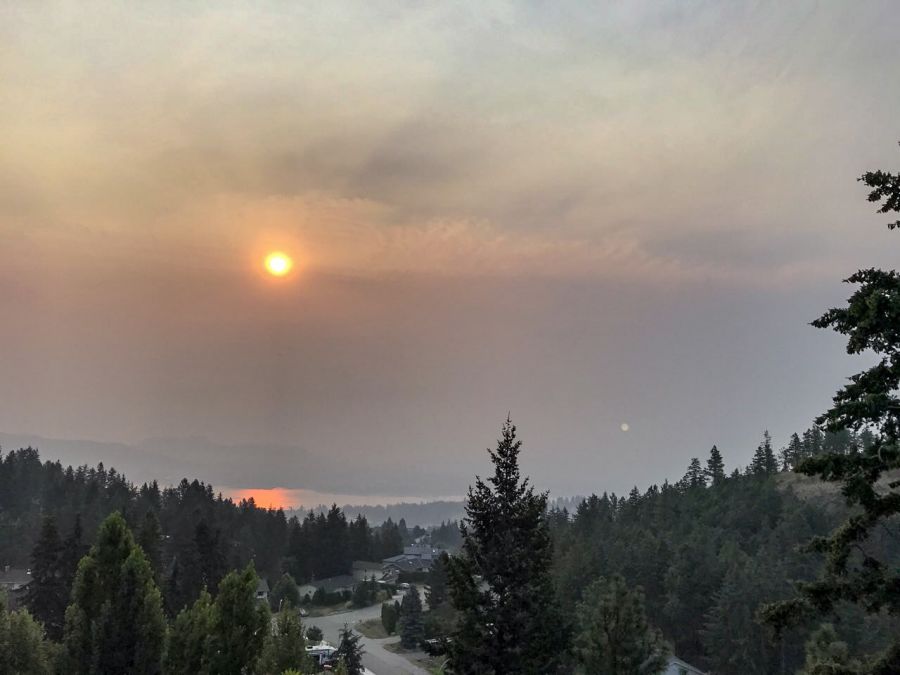
While you may find the increased smokey haze in our valley unpleasant, the irony is that it will act like cloud cover, filter the sun and help suppress our daytime high by a couple of degrees. Hopefully this will keep us below the the 30-30-30 threshold.
The shift this weekend from a warm to a cooler air mass will also help, however, transitions of this nature often bring with them an increased risk of lightning and wind for a brief period.
Please stay weather and wildfire aware. Report any signs or irresponsible behaviour to the BC Wildfire Service by dialing *5555 from your cell phone.


