British Columbia has seen plenty of snow this winter, but that doesn't mean the provinces' mountains are.
Single day snowfall records were shattered in multiple B.C. cities over the last month, but across the province the snowpack is below average, according to figures from the B.C. River Forecast Centre.
"We look at the province as a whole. We're at about 79% of normal," said Dave Campbell, who heads the forecast centre.
"Because we've had a number of snow events in the populated areas that don't normally see that much snow, the Lower Mainland and other communities, there is that perception people are seeing and dealing with more snow than they normally do," said Campbell.
The South Coast, Lower Fraser and Nechako regions are the only areas of B.C. where the snowpack is relatively normal for this time of year.
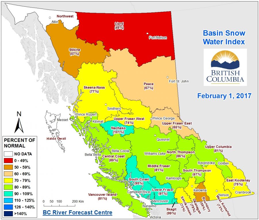
The Thompson-Okanagan is sitting at 70-79% of its average snowpack for this time of year.
A lesser snowpack means less water supply for irrigation, an essential service for the Thompson-Okanagan's agriculture sector.
It also leads to below average spring run-off, which has potential to make the rolling hills of the Thompson-Okanagan more susceptible during wildfire season.
Snow fell much more in populated centres and valleys than at the tops of mountains, Campbell said, resulting in lower snowpacks in much of the province.


