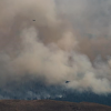
The BC Wildfire Service (BCWS) says a fire burning north of Fort St. John has prompted new evacuation orders and alerts after growing significantly over the weekend.
An update from the agency was provided late Monday night and estimates the Donnie Creek wildfire at 157,500 hectares.
This is 21,500 ha more than the size estimate provided on Sunday.
The BCWS says it is displaying “high-vigour” rank fire activity. This means that there is an organized surface flame front with moderate to fast rate of spread on the ground and short-range spotting.
The BCWS says conditions are expected to remain hot and dry this week, bringing the risk of aggressive fire behaviour.
“No rain is forecasted for the foreseeable future. Curing of forest fuels is ongoing as a result of longer daylight hours, sunny weather, winds and a drier airmass,” the agency says.
“Where wind, open flame and fuels align, significant fire activity is anticipated to occur on the Donnie Creek wildfire this week.”
The lightning-caused blaze continues to be the province’s only wildfire of note, meaning it is highly visible or poses a potential threat to public safety.
As a result, BCWS crews will conduct planned burns over the next three to five days to better contain the fire. Smoke will be highly visible from Highway 97 between Fort St. John and Fort Nelson.
The agency says this will remove forest fuels and bring the fire’s edge to established control lines to reduce further spread. Ground crews and heavy machinery have already constructed control lines along Hwy 97.
Many of the evacuation orders issued by the Peace River Regional District and Northern Rockies Regional Municipality are mostly in place for remote oil and gas work camps or other industry-related infrastructure.
More hot weather is on the way for most of BC with temperatures expected to reach the high 20s in northern parts of the Interior while temperatures are expected to once again soar into the low-mid 30s in the southern and central Interior.
As of May 30, most of the coastal and northeastern parts of BC are under a high to extreme fire danger ratings with "extremely" dry forest fuels and a very serious fire risk.
In the Interior, the fire danger rating ranges from low in the Shuswap and Kootenays to moderate and high in parts of the Thompson-Okanagan.


