Account Login/Registration

Access KelownaNow using your Facebook account, or by entering your information below.


Facebook


OR


Register

Privacy Policy

Satellite photos of BC reveal frightening smoky transformation

BC residents and visitors are experiencing a salient difference in air quality from the ground, but how does the province look from beyond the smoke and ash?

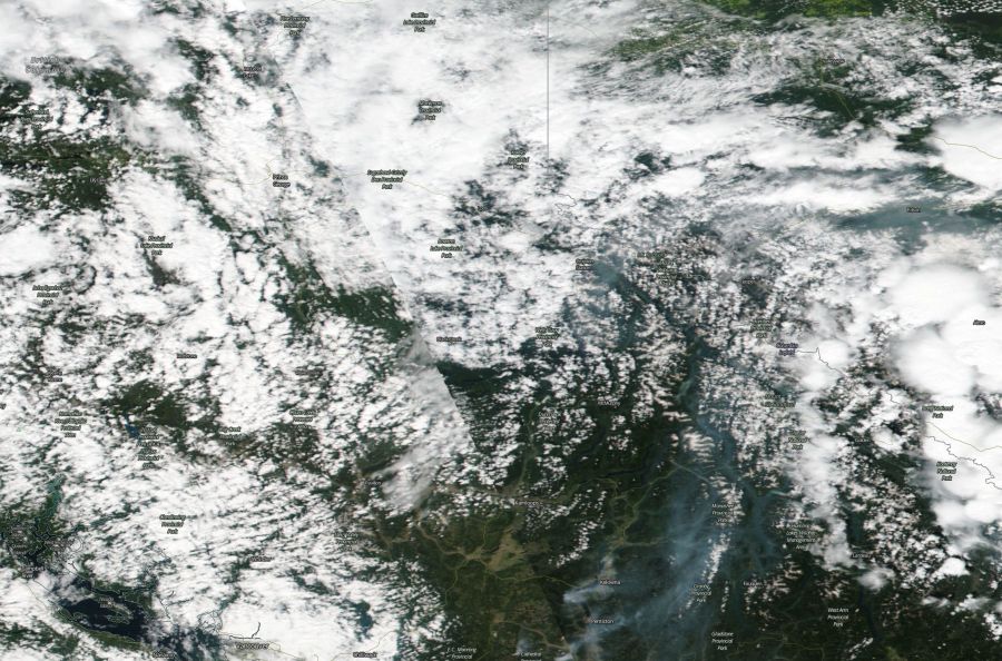
BC Wildfire shared a photo of how the westernmost province looks from the cosmos and it reveals a ghastly cape of smoke looming over the province.

In comparison to the photo shared by BCWS, here is a photo of the same area on July 19, 2018 — exactly a month ago.

<who>Photo Credit: NASA</who>

The smoke is inhibiting aviation efforts, posing challenges both in the geographic mapping of the fires as well as the suppression of fires.

Additionally, according to Environment Canada, the smoke will hover over the Kamloops Fire Centre area for the foreseeable future with some areas escaping the smog due to fluctuating wind patterns and fire characteristics.

Be safe with the smoky skies, avoid strenuous activity outdoors and prolonged exposure to the smoke.

To check how BC is changing day-by-day, visit the worldview map here.


If you get value from KelownaNow and believe local independent media is important to our community we ask that you please consider subscribing to our daily newsletter.

If you appreciate what we do, we ask that you consider supporting our local independent news platform.


Send your comments, news tips, typos, letter to the editor, photos and videos to news@kelownanow.com.


weather-icon
Tue
20℃

weather-icon
Wed
17℃

weather-icon
Thu
16℃

weather-icon
Fri
16℃

weather-icon
Sat
17℃

weather-icon
Sun
17℃

current feed webcam icon

Recent Livestream


Top Stories

Follow Us

Follow us on Instagram Follow us on Twitter Like us on Facebook Follow us on Linkedin Follow us on Youtube Listen on Soundcloud Follow Our TikTok Feed Follow Our RSS Follow Our pinterest Feed
Follow Our Newsletter
Privacy Policy