(UPDATE: Aug. 17 @ 6:40 pm) – The Pine River started Friday, Aug.13 and has grown to 2,542 hectares.
BC Wildfire Service says that the fire received a significant amount of rainfall on Monday, Aug. 16 and fire activity was minimal.
However, the agency is reporting that “high winds occurred through the day yesterday and are forecasted to continue today.”
There are nine firefighters, two helicopters and one structure protection specialist on site.
DriveBC is not reporting any road closures due to this wildfire.
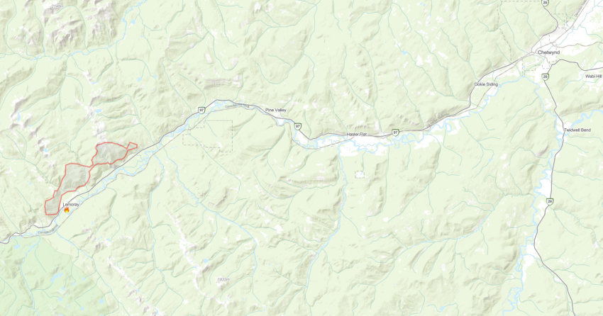
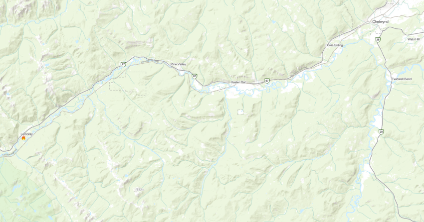
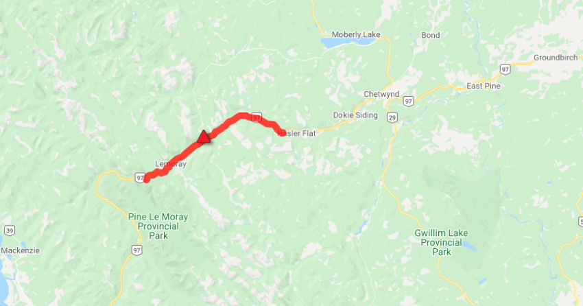
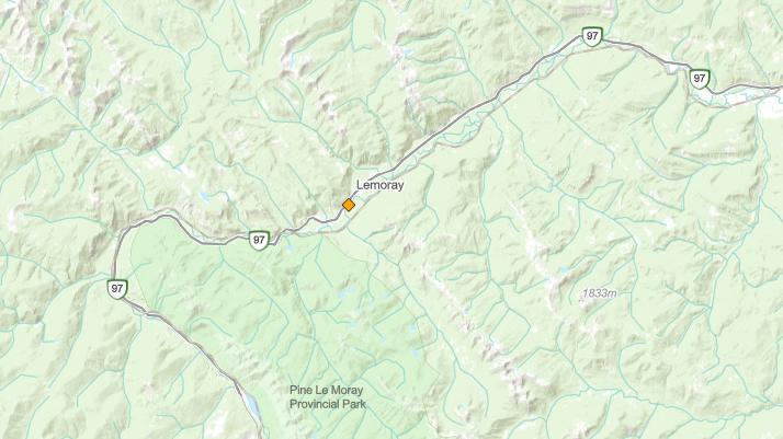
The fire is located between Powder King Road and Old Hasler Road, be sure to check road conditions before travelling.
“Crews and heavy equipment completed a fire guard to the east of the Pine River wildfire yesterday. Today, crews are continuing to mop up along the south flank.”
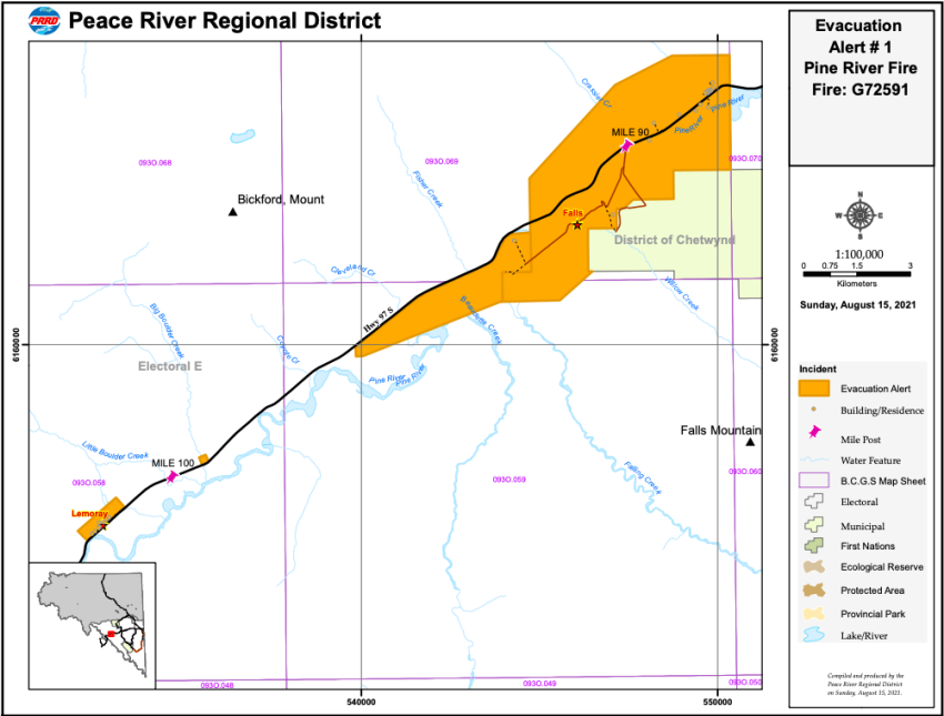
The evacuation alert issued by the Peace River Regional District remains in effect.
(UPDATE: Aug. 15 @ 4:45 pm) – The Pine River wildfire has grown only seven hectares overnight.
The fire is now estimated at 2,007 hectares and the cause remains under investigation.
There are eight firefighters, two helicopters, two pieces of heavy equipment and structure protection personnel working on the fire today.
DriveBC is not reporting the road closure as a major incident as Highway 97 between Powder King Road and Old Hasler Road remains open.
BC Wildfire Service notes that activity on this fire remained low and the area received approximately 9 millimetres of rain.
However, the agency is forecasting a cold front to move through the fire centre bringing wind gusts up to 70km/h.
These wind gusts could increase fire activity overnight.
“Crews and equipment are working today to establish a fire guard along the east side of the fire. Crews are continuing to mop up along the south flank.”
BC Hydro completed an inspection of several transmission lines in the area yesterday and reported no damage to the structures.
“An additional flight occurred this morning, August 15. All three 500kV transmission lines are in service at this time,” notes the BCWS update.
The Peace River Regional District issued an evacuation alert for electoral area “E” in the vicinity of Mount Lemoray.
(UPDATE: Aug. 14 @ 2:15 pm) – The Pine River wildfire is now estimated at 2,000 hectares.
The fire is burning out of control and the cause remains under investigation.
There are 10 firefighters, four helicopters and structure protection personnel on site.
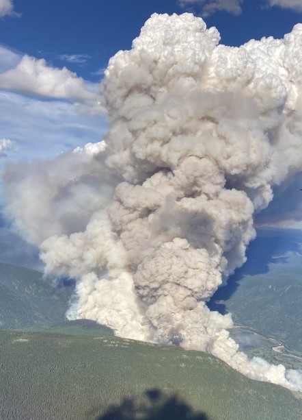
BC Wildfire Service is reporting rank four and five fire behaviour which “resulted in significant fire growth.”
Crews worked overnight to deploy structure protection equipment in the area.
Today, they will continue to establish that equipment while protecting the wooden power poles in the area.
Crews will work to contain the fire on the north side of Highway 97.
DriveBC reports that the highway is closed in both directions between Powder King Road and Old Hasler Road for 43.3 kilometres.
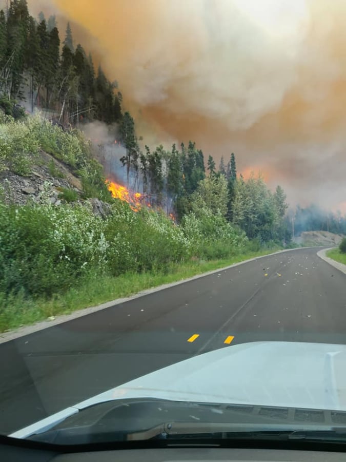
(Original Story: Aug. 13 @ 8 pm) – A new wildfire near Chetwynd has resulted in the loss of structures as it burns “extremely vigorously.”
The BC Wildfire Service said that the fire, which started earlier today, is located in the area of Pine River between Chetwynd and Mackenzie. It is currently estimated at 150 hectares in size, and is classified as out of control.
Officials confirmed that structures have been lost and additional structures are immediately threatened.
This wildfire has also impacted a major BC Hydro transmission line, and Highway 97 is closed between Powder King Road and Hasler Road.
BC Wildfire Service says that visibility is limited due to the smoke column, and air tankers operations may be impacted.
A helicopter and an Incident Commander are on site. Additional resources are en route.


