Fall is a beautiful time of year with the colourful foliage and the lush vineyards, but this is also the time of year when we start noticing the development of an annual weather phenomenon that is unique to valleys like the Okanagan.
Over the past several days we’ve been under a very persistent upper ridge over our region. An “upper ridge” is a meteorological term that means we have warm air in the atmosphere well above the surface, creating a very stable, stagnant and slack weather pattern.
Whenever we see this type of a weather pattern, it usually means we get the pleasant weather this region is known for - sunshine.
However, Mother Nature likes to keep us on our toes and for a few months of the year, this is not the case. Despite the high pressure that develops during times of an upper ridge, this is also the recipe for a weather occurrence that locals are familiar with from mid-October until March - valley fog and cloud.
For the past couple of days, we’ve seen the fog develop in the morning hours as this is also when it is the coolest part of the day. This is because cool air cannot hold moisture as well as warm air.
Take a deep breath and then imagine releasing the air out of your lungs on a cold, crisp day. You can see your breath. If you do that during the summer season, the breath that you blow out is not visible because the air is much warmer.
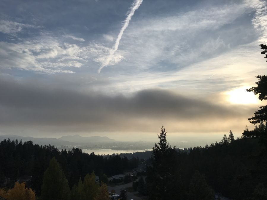
Because fog is water, when the moisture content of a parcel of air is high on a cool morning, we can visually see the fog, especially above bodies of water like Okanagan Lake. As the water from the lake evaporates into the air right above it, the air right above the lake becomes saturated or full of water content. Combine that with cool air that can’t hold moisture well, and voila - you get fog above the lake.
Another ingredient to the valley fog and cloud recipe is the decreasing of the sun angle at this time of year. This is why we usually see a gradual trend from morning fog in mid fall, to valley cloud by late fall or early winter.
As Earth continues to orbit around the Sun at 23.5 degrees, the sun angle over the Okanagan decreases as fall progresses. This results in less solar radiation and therefore less warming of our valley.
Remember the part about cool air not being able to hold moisture as well? Combine the cool fall and winter temperatures with shorter daytime hours, and the air in the valleys just do not receive enough solar radiation or warmth to allow the fog and clouds to dissipate.
The outcome is morning valley fog in mid fall, and valley cloud by the winter season. So get outside and enjoy the long stretch of fall sunshine while you still can!


