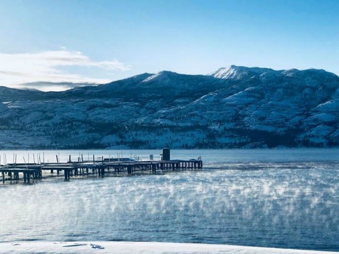
As Arctic air blows through British Columbia, many regions hit record low temperatures overnight.
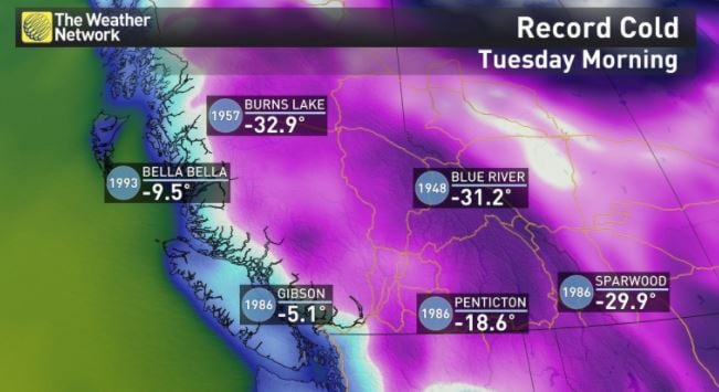
This morning, southern B.C.'s Penticton beat its 1986 record low of -18.6 C.
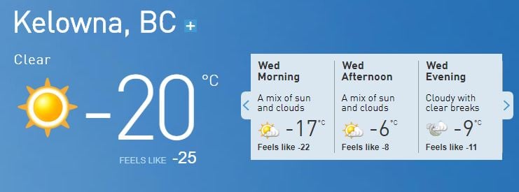
Kelowna's cold snap came close to hitting a record low overnight.
"An Arctic ridge over B.C. has given clear cold conditions the last few nights," said a spokesperson for Environment Canada.
While it feels like -25 C in Kelowna, it's currently -20 C. The lowest recorded temperature in Kelowna for the month of February is -22.3, recorded on Feb. 1, 1996.
The good news is the cold snap should taper out over the next few days and the weather should start to get warmer.
Tonight, temperatures are expected to drop to -13 C, followed by a low of -10 C on Thursday evening, -7 C Friday night and -4 C Saturday evening.
If the temperatures follow the Weather Network's forecast, we should be able to thaw our hands and faces within a few days - seeing warmer temperatures and a fresh batch of snow - perfect conditions for skiing or snowshoeing.
Other areas with recorded lows include Burns Lake, Bella Bella, Blue River, Gibson, Sparwood and Penticton.
For your latest updates, visit the Weather Network.


