Several communities throughout the Interior are under a flood watch or high streamflow advisory on Monday.
The BC River Forecast Centre issued the advisories late Sunday evening.
“The high-pressure ridge that brought very hot temperatures to the region has broken down and weather conditions have transitioned to more unsettled patterns,” says the BCRFC.
“On Monday, convective precipitation is expected to continue with 15-25 mm precipitation possible through the region.”
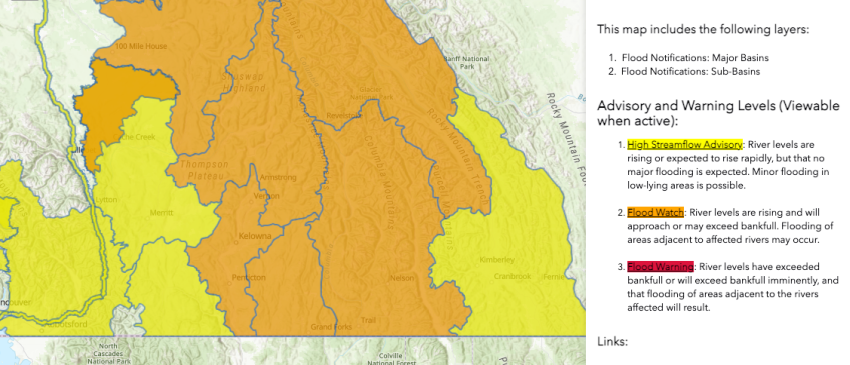
The following regions are currently under a flood watch:
-
Shuswap River
-
Bonaparte River
-
Cache Creek, Deadman River and other nearby tributaries (NEW)
-
North Thompson River including Barriere, Clearwater, Blue River and surrounding areas
-
South Thompson River and including tributaries around Chase, Tk’emlúps te Secwépemc, Splatsin, Salmon Arm, Salmon River, Sicamous, Enderby and surrounding areas and surrounding areas (UPGRADED)
-
Okanagan including Mission Creek and tributaries around Syilx Territory, Vernon, Kelowna, Penticton and surrounding areas
Meanwhile the Similkameen, including the Ashnola and Tulameen rivers, are under high streamflow advisories.
The Nicola and Coldwater rivers near Merritt and Thompson River downstream of Kamloops Lake are also under a high streamflow advisory.
The BC River Forecast Centre says the upcoming weather pattern is similar to thunderstorms that caused flooding on Mission Creek near Kelowna in June 2022.
Meanwhile, Environment Canada issued a Special Weather Statement on Sunday, May 21 at 11 am, indicating that heavy rainfall is expected on Tuesday, May 23 over much of the North Thompson, South Thompson and Bonaparte River watersheds.
The public is advised to steer clear of fast-flowing rivers and unstable creek or river banks.


