It feels like summer has finally arrived in the Okanagan.
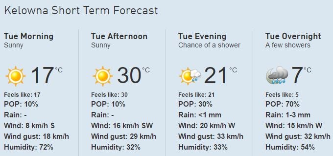
After a warm, sunny long weekend, things get even better on Tuesday with a forecasted high of 30°C.
This matches the temperature seen in 2015, when it hit a high of 30°C on the nose on May 23rd.
It only reached 20.4°C and 22.3°C on May 23rd in 2016 and 2014 respectively.
Although it’s perfect beach weather, most local waterfronts remain closed due to flood risks, making a local water park or even a backyard sprinkler an attractive option to beat the heat.
It won’t last long, however, as there’s a small chance of showers later on Tuesday evening, which carries over into Wednesday.
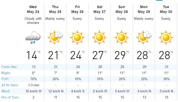
On Wednesday, the high will be less than half of what it’s expected to get to on Tuesday, with rain and thunderstorms in the forecast.
However, we’ll be back to summer weather by the end of the week with another sunny weekend in the forecast, which is expected to continue into next week.
Warmer temperatures could cause an increased flood risk, which you can find out more on here.


